 Occasional Papers (2009-)
 Site Visualisations
Kandahar
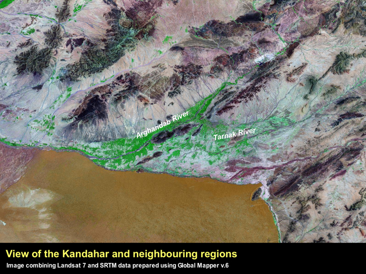
Kandahar is situated on an alluvial plain at the edge of the Rigistan Desert, which is watered by the Arghandab and Tarnak Rivers. The proximity of such an unusual combination of geographic features is clearly visible on the Landsat 7 image above.
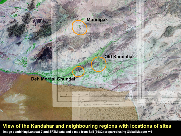
When a map from the Ball (1982) gazetteer is draped onto the Landsat 7 image, it is clear that the evidence for human occupation, as attested by the identification of archaeological sites, appears to be limited to the fertile intermontane areas. We can only assume that this is not a product of the way in which the region was surveyed. This image makes it the clear that Mundigak and Deh Morasi Ghundai (and Old Kandahar) are separated from each other by several substantial ridges and are actually watered by two different river systems.
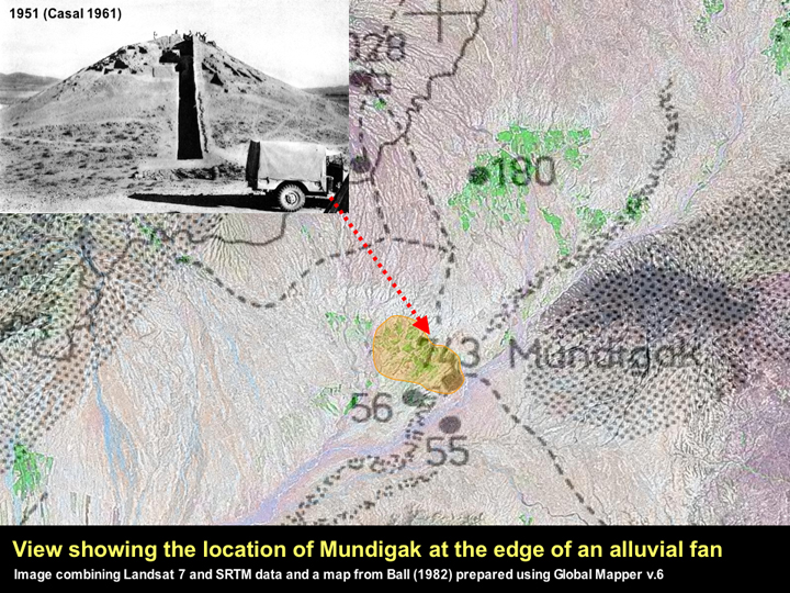
The site of Mundigak is comprised of several mounds, and the occupation at the site ranges in date from the 4th to the late 1st millennium BC (Casal 1961). Given that the site appears to be one of the earliest occupied village sites in the region, it is notable that the Landsat 7 image appears to indicate that the mounds were located at the edge of a substantial alluvial fan. This is particularly interesting in regard to the origins of farming in the region, and resonates with Andrew Sherratt's suggestion that the earliest forming villages in the Levant were situated in close proximity to alluvial fans, and the abundant water resources and fertile land that was associated with them that are ideal for floodwater farming (Sherratt 2007, 2005: visit Origins of Farming).
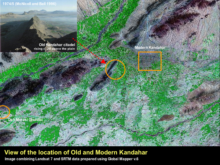
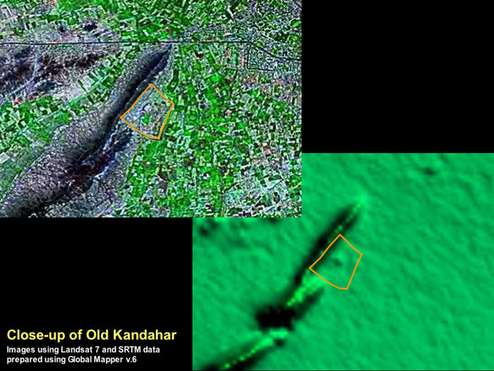
Old Kandahar is one of the most important Early Historic city sites in Central Asia, being dominated by a massive artificial citadel that rises around 20 m above the surrounding plain, which is in turn surrounded by a substantial mud-brick fortification wall, that encloses an area in excess of 1000 x 500 m. In many respects it resembles several of the other major Early Historic cities that are known in Afghanistan and the NWFP, including Begram, the Bala Hisar at Charsadda, Akra in the Bannu District of Pakistan and the Sirkap mound at Taxila. Although the dating for the earliest foundations for virtually all of these sites are at present unclear (Coningham 2004; Magee et al. 2005), it is significant that they all appear to have been urban centres in the early 1st millennium BC, which is a period that appears to be marked by a lack of urban centres on the Indus flood plain and the Ganges doab.
In many respects the remains of Old Kandahar were so well preserved (at least up until the 1970s) thanks to the fact that the city was moved to the site of Modern Kandahar in 1747 by Ahmad Shah Durrani (Helms 1982). However, very little information is available about the state of the Old Kandahar remains today, and in this context, it is interesting to look and see what is visible from the satellite images.
◄ Return to Remote Sensing in Inaccessible Lands