Virtual globes, geotagging and global landscapes

Department of Archaeology, University of Sheffield
SATURDAY, 3rd MARCH 2007
Susan Sherratt
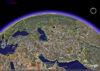
Mapping Human History from Space took place on 3rd March 2007. The aim of this one-day Workshop was to explore and demonstrate the exciting possibilities offered by the combination of satellite imagery, GIS techniques, environmental and palaeogeographical data, and information from archaeological surveys to reconstruct early settlement history in the Near East. Seven scholars from the United Kingdom, USA, Germany, Switzerland and Turkey, all actively engaged in using satellite imagery and GIS techniques to illuminate various aspects of the archaeology of this crucial part of the ancient world, presented their research at the Department of Archaeology, University of Sheffield. The abstracts and presentations from the Workshop are published here as visual essays on the ArchAtlas website. Together they show the wealth and breadth of the possible applications of these techniques. The wide-ranging discussion of the advantages of using such combined approaches to create a more integrated view of Old World prehistory and history which followed the lectures are reflected in the presentations as they are published here.
The event was also an opportunity to discuss the future development of ArchAtlas itself, the results of which will be shown in the changes and advances to be seen in the forthcoming Edition 3 of the website! In particular, we hope that this will be the first in a regular series of Workshops to be published in the new ArchAtlas Journal in formats which would not be possible in traditional print media.
Sponsored by the British Academy


