 Occasional Papers (2009-)
 Site Visualisations
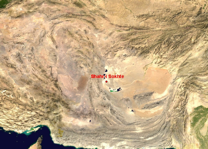
NASA Blue Marble true-colour global imagery [1km resolution]
Location map: the Near (Middle) east showing the location within Iran of the major Bronze Age (3rd and early 2nd millennium BC) site of Shahr-i Sohkte (also transcribed as Shahr-e Sokhta, Shahr-e Sukhteh etc.).
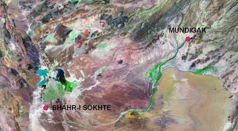
Landsat image, 30m resolution, circa 1990, with Band 7 displayed as red, Band 4 as green and Band 2 as blue.
Landsat TM imagery provided by NASA.
Relative locations of Shahr-i Sokhte and Mundigak (near Kandahar, Afghanistan), along the Helmand river. Settlement clusters either along the edges of the mountains, or in the river-delta which forms an oasis of settled life.
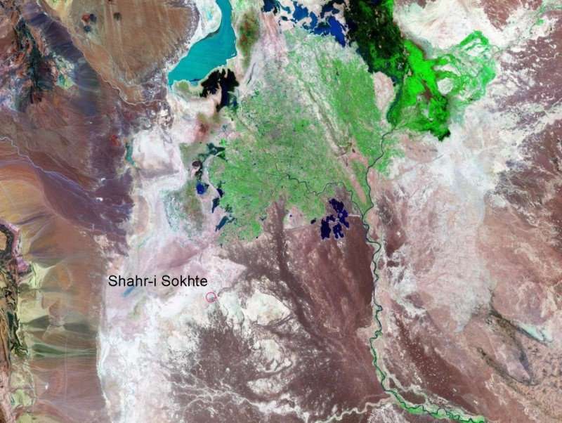
Landsat TM imagery provided by NASA.
The Helmand delta shows a characteristic pattern of successive alluvial cones of deposition, with reedswamp and seasonally fluctuating lakes beyond. Cultivation is concentrated on the active fan.
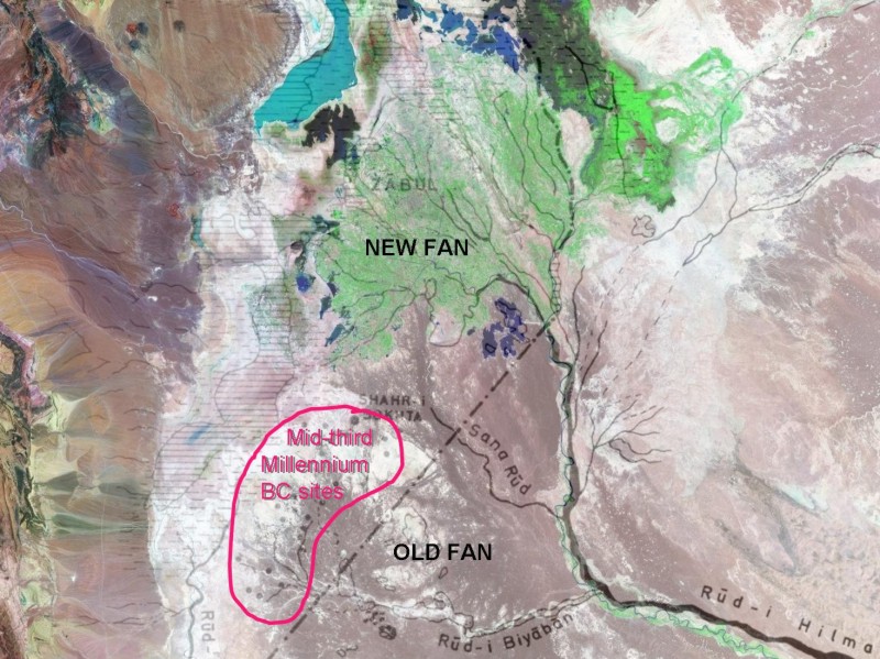
Landsat TM imagery provided by NASA.
Survey of evidence for Bronze Age settlement, superimposed on the above image, showing the concentration of activities on a then active but now largely abandoned alluvial fan. (Map from Tosi 1973)
Landsat TM imagery provided by NASA.
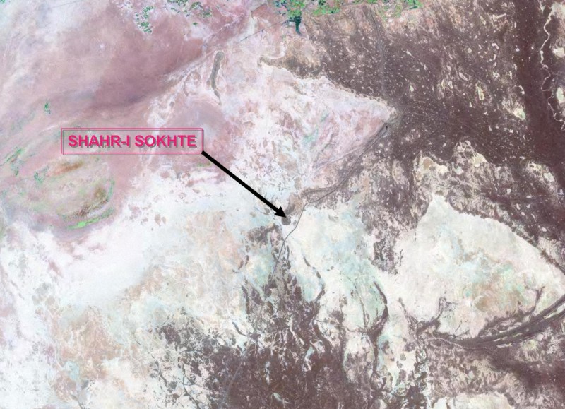
Enlarged segment of the previous satellite image, showing the contrast between Plio-Pleistocene terraces (brown) and the later floodplain (white).
From Tosi 1984.
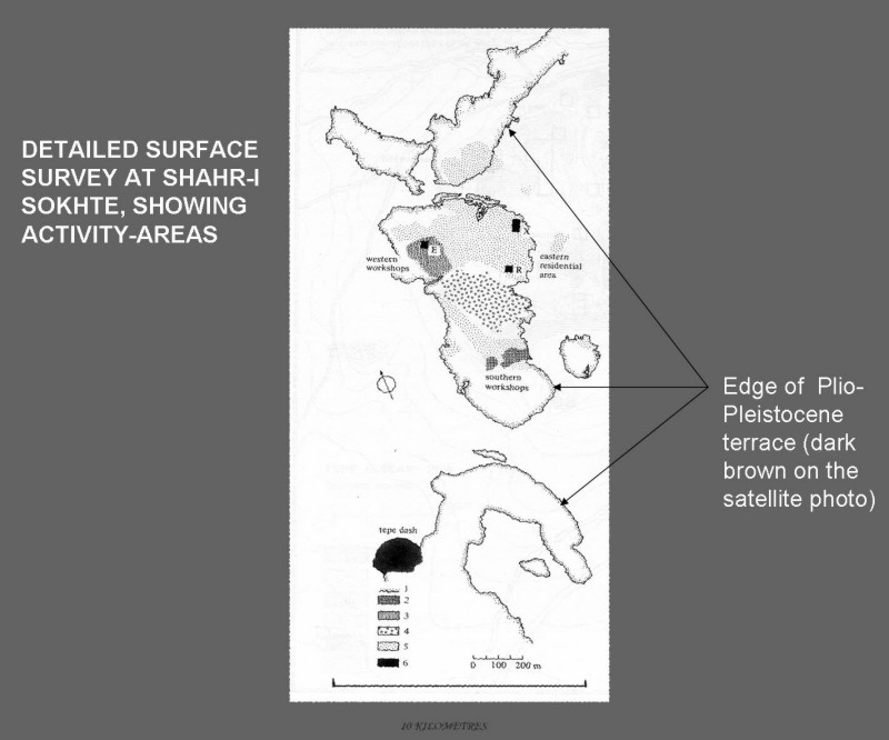
Results of surface survey and excavation in the areas of terrace-edge visible in the above satellite image, with classification according to major functional areas, after survey by Tosi et al..
Landsat TM imagery provided by NASA.
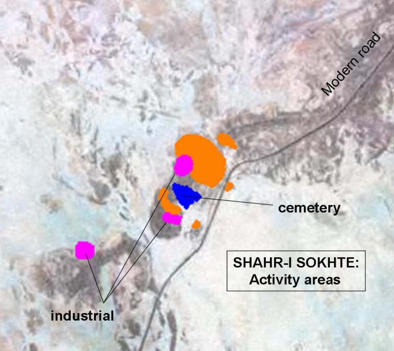
Approximate location of activity areas identified above on this 30m resolution Landsat image.
Referenced sites
| Site Name | Country | Latitude | Longitude | OpenAtlasID |
|---|---|---|---|---|
| Shahr-i-Sokhta | ir | 30.592481 | 61.325301 | ir/shahrisokhta |