 Occasional Papers (2009-)
 Site Visualisations
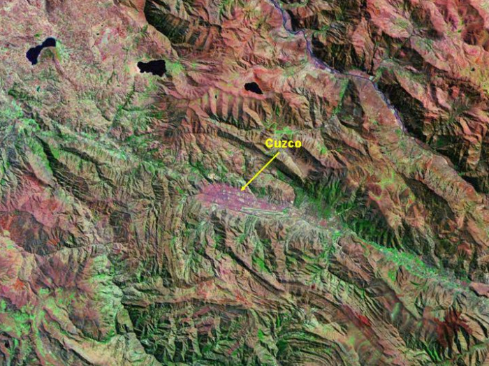
Landsat TM image, 30m resolution, circa 1990, with Band 7 displayed as red, Band 4 as green and Band 2 as blue.
Landsat TM imagery provided by NASA.
Cuzco occupies a relatively narrow east-west valley, constrained by hills on either side.
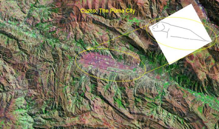
Landsat TM imagery provided by NASA.
With the hilltop fortress of Saqsaywaman, the layout of Cuzco resembles a puma.
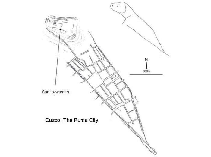
The Inkas: last stage of stone masonry development in the Andes, Francesco Menotti (1998)
The street-plan of Cuzco shows its puma-like layout, with its fortified 'head' containing the military and administrative nerve-centre (Menotti 1998)
Referenced sites
| Site Name | Country | Latitude | Longitude | OpenAtlasID |
|---|---|---|---|---|
| Cuzco | pe | -13.522134 | -71.983346 | pe/cuzco |