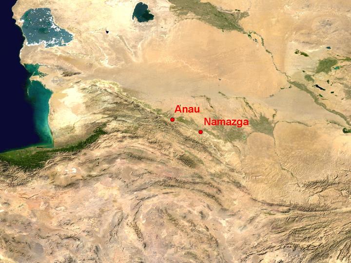
NASA Blue Marble true-colour global imagery [1km resolution]
Turkmenistan presents stark contrasts in environment, between the better-watered mountains and the sands of the Kara Kum (black sand) desert. Early settlement was concentrated in a narrow strip on the northern edge of the mountains, where rivers entered the plain.
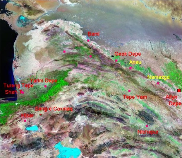
Landsat TM image, 30m resolution, circa 1990, with Band 7 displayed as red, Band 4 as green and Band 2 as blue
Landsat TM imagery provided by NASA.
The thickly-wooded Elburz mountains, on the southern shore of the Caspian, were unattractive to early farmers; but the areas on either side of the chain, on the edges of the arid plains but watered by mountain streams, were very suitable for Neolithic occupation. Mobile groups of foragers occupied the deserts beyond the mountains, for instance along the Uzboi river (visible in the north-east corner of the image). The area produced many important minerals and decorative stones such as turquoise.
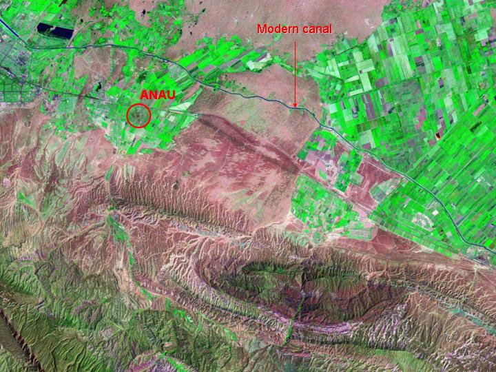
Landsat TM imagery provided by NASA.
The long-occupied site of Anau, subject of a pioneering early 20th century expedition, occupies a classic position at the outlet of a small, well-watered valley. The more extensive areas of green at the present time all depend on a recently-constructed irrigation canal.
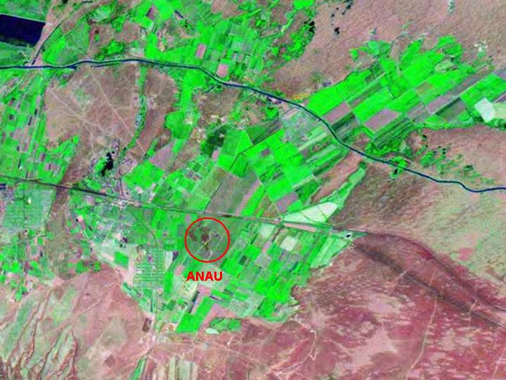
Landsat TM imagery provided by NASA.
The site is a large and easily visible mound, positioned in relation both to stream discharge across the fan and to traffic along the piedmont route.
Landsat TM imagery provided by NASA.
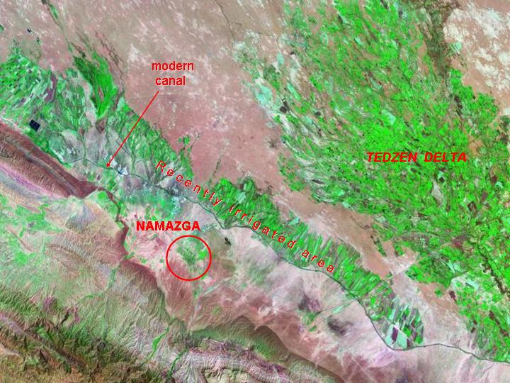
The equally important and long-lived site of Namazga occupies a comparable position, and the area in front of it is also sustained artificially by a modern irrigation-canal. To the east is the delta of a much larger river, the Tedzhen, which supported many sites including the major centre of Altyn Depe.
Referenced sites
| Site Name | Country | Latitude | Longitude | OpenAtlasID |
|---|---|---|---|---|
| Anau | tm | 37.896448 | 58.545658 | tm/anau |
| Namazga Depe | tm | 37.372852 | 59.556968 | tm/namazga_depe |
 Occasional Papers (2009-)
 Site Visualisations