ArchAtlas journal articles which mention this site
Ancient Near Eastern Route Systems: From the Ground Up

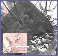
A particularly common trace of ancient route systems on the ground is the 'hollow way'. In the Middle East hollow ways, like their counterparts in the UK and Europe, appear as long, usually straight valleys. This paper examines the traces of these ancient route systems in the Ancient Near East according to their pattern, processes of formation, parallels elsewhere, and their function.
Quantitative approaches to the remote sensing of ancient settlements

Tells, the characteristic settlement mounds of the Near East, are visible remains of the first human settlement system. Often piled up to considerable heights by the debris of millennia of settlement activity, they provide characteristic physical signatures, such as specific elevation profiles or soil changes, which – potentially – can be detected in data available from space-borne sensors. Using methods from pattern recognition and statistical learning, we systematically evaluated digital elevation models and multispectral imagery to provide means for a machine based detection and mapping of these archaeologically relevant settlement sites.
Virtual Survey: a semi-automated tellspotting algorithm

Following the observation that prehistoric and early historic settlement-mounds (tell settlements) in parts of the Near and Middle East can be recognized in the SRTM 90m terrain model (Sherratt, Antiquity 2004) an algorithm has been developed to do this automatically, using current techniques of computer modeling.
 Occasional Papers (2009-)
 Site Visualisations