 Occasional Papers (2009-)
 Site Visualisations
Obsidian, a black volcanic glass, was first recognized by Colin Renfrew and his colleagues J.E. Dixon and J.R. Cann in the 1960s as a uniquely sensitive indicator of prehistoric trade, both because of the great desirability of this material before the use of metals, and also because the trace-elements it contains are usually diagnostic of individual sources. Work on Near Eastern obsidian in the Neolithic period has been a particular focus of interest, and a summary of current results has been published by M.-C. Cauvin et al., L'obsidienne au Proche et Moyen Orient: du volcan à l'outil (Oxford: BAR Int. Ser. 738), from which the information in the following maps has been extracted. They indicate a remarkable story, from limited circulation (though still over impressive distances) by late-Pleistocene hunter-gatherers, to its increasing use by the first farming communities – initially distributed along a few axial routes but then flowing through a more reticulated network. The maps are particularly useful since they indicate the flows of material from two major source-areas, initially separate but increasingly inter-penetrating. (Obsidian from other sources, e.g. around Lake Van and in the Transcaucasus, is not shown).
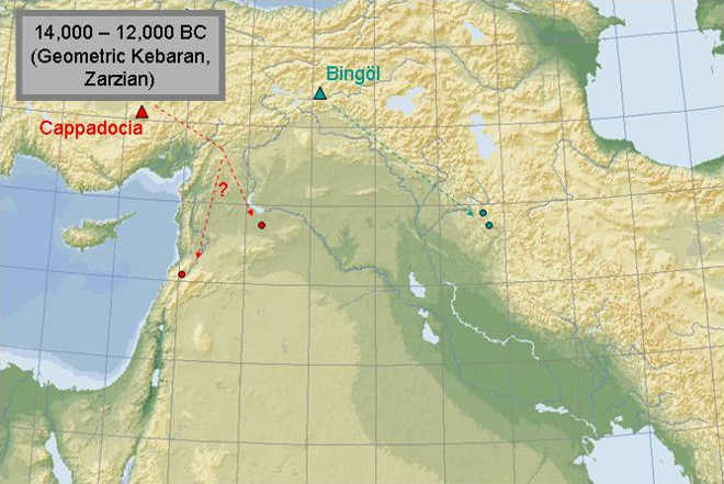
1) The earliest evidence of long-distance trade in obsidian occurs during the late-glacial period, in the still-open landscapes before the spread of forests, when it circulated among Epipalaeolithic hunting and foraging groups around the Fertile Crescent. Two chains of connection are already evident: obsidian from the Bingöl region of south-east Turkey reached Iraqi Kurdistan (via the Hilly Flanks route), and obsidian from the Cappadocian area of central Turkey was carried across the Taurus to the middle Euphrates and the northern Levant (the Levantine Corridor).
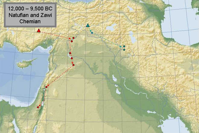
2) During the rapid climatic swings which brought the late-glacial period to an end, in which a warmer Allerød phase was followed by a colder Younger Dryas phase, increasingly sedentary communities continued to trade obsidian, which penetrated the whole length of the Levant. The middle Euphrates seems to have been an important intermediate region in this transmission.
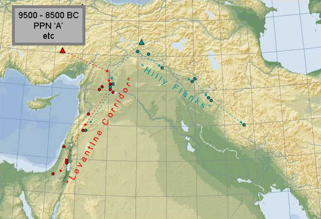
3) The first farming communities (Pre-pottery Neolithic A) appeared in the warm conditions which marked the beginning of the postglacial period, and increased quantities of obsidian (both from Cappadocian and Bingöl sources) came into circulation. Although each source dominated in it own area (Cappadocian in the west and Bingöl in the east), some Bingöl obsidian reached the middle Euphrates and some traveled further down the Levant.
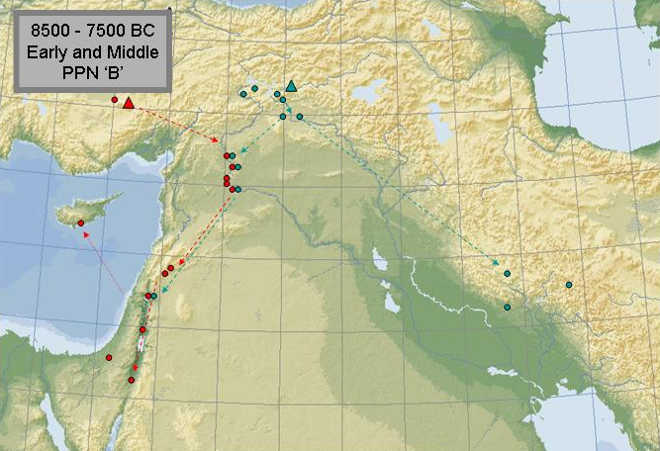
4) The full impact of farming and domestic livestock came with Pre-pottery Neolithic B after 8500 BC, when farming communities expanded both to Cyprus and Cappadocia – in the latter case, no doubt drawn by the high-grade obsidian resources, which were traded around the entire middle Euphrates and Levant, and indeed over to Cyprus. Bingöl obsidian now traveled east as far as the middle Zagros.
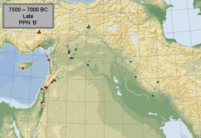
5) During the Late PPNB the first pieces of Cappadocian obsidian appeared on the north-Levantine coast, and at the same time greater exchanges between the eastern and western wings of the northern Fertile Crescent were mediated through sites like Bouqras on the Euphrates, sustained by its trading links in both directions. In many parts of the region the traffic was handled by major sites such as Çatalhöyük, Tell Abu Hureyra, Beisamoun, Ain Ghazal and Tell Basta.

6) In the Final PPNB period (in which pottery was in use in some areas) the coastal parts of the northern Levant, previously showing no evidence of Neolithic occupation (and probably occupied by forest foragers) now show impressive amounts of Cappadocian obsidian in Neolithic contexts. This probably indicates a new trade route to the Levant via Cilicia and the coast. This supplemented the earlier central-Euphrates route, and reduced the role of the Levantine super-sites such as Ain Ghazal, which had previously enjoyed a near-monopoly. Obsidian now reached a greater diversity of sites by a variety of routes.