Important news about the threat to the Dept of Archaeology at the University of Sheffield... Read more...

Mapping Human History from Space:
Tells, Routes and Archaeogeography in the Near East

Department of Archaeology, University of Sheffield
SATURDAY, 3rd MARCH 2007
Susan Sherratt

Mapping Human History from Space took place on 3rd March 2007. The aim of this one-day Workshop was to explore and demonstrate the exciting possibilities offered by the combination of satellite imagery, GIS techniques, environmental and palaeogeographical data, and information from archaeological surveys to reconstruct early settlement history in the Near East. Seven scholars from the United Kingdom, USA, Germany, Switzerland and Turkey, all actively engaged in using satellite imagery and GIS techniques to illuminate various aspects of the archaeology of this crucial part of the ancient world, presented their research at the Department of Archaeology, University of Sheffield. The abstracts and presentations from the Workshop are published here as visual essays on the website. Together they show the wealth and breadth of the possible applications of these techniques. The wide-ranging discussion of the advantages of using such combined approaches to create a more integrated view of Old World prehistory and history which followed the lectures are reflected in the presentations as they are published here.

The event was also an opportunity to discuss the future development of itself, the results of which will be shown in the changes and advances to be seen in the forthcoming Edition 3 of the website! In particular, we hope that this will be the first in a regular series of Workshops to be published in the new Journal in formats which would not be possible in traditional print media.

British Academy logo

Sponsored by the British Academy


Virtual globes, geotagging and global landscapes
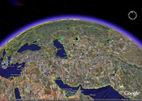
This paper raises a series of broad issues about a particular set of new technologies which have become available for Mapping Human History from Space, namely: virtual globes, such as Google Earth and NASA's WorldWind, and their relationship to online archaeological datasets. First, some of technical background to these visualisation programs is explained, especially how they stand in relationship to previous GIS approaches. Issues with the increasing trend within archaeology, to publish site locations and other archaeological information using online databases are raised; and the possibilities and problems for a global archaeological atlas and the integration of multiple databases are explored. Finally the paper touches on the possible future research applications of initiatives which use novel visualisation and integrative databases.

Quantitative approaches to the remote sensing of ancient settlements

Tells, the characteristic settlement mounds of the Near East, are visible remains of the first human settlement system. Often piled up to considerable heights by the debris of millennia of settlement activity, they provide characteristic physical signatures, such as specific elevation profiles or soil changes, which – potentially – can be detected in data available from space-borne sensors. Using methods from pattern recognition and statistical learning, we systematically evaluated digital elevation models and multispectral imagery to provide means for a machine based detection and mapping of these archaeologically relevant settlement sites.

Agricultural and Pastoral Landscapes in the Near East

The Near East presents particular challenges to the study of past landscapes. Remote sensing has been a part of archaeology for a century, and aerial photographic coverage is now the ideal and standard for field survey basemaps. Such coverge, however, is not globally available. In the modern Middle East, for example, easy access to aerial photography is often impossible to obtain. As a result, archaeologists have turned to satellite imagery. Unfortunately, the resolution of space-based imaging systems such as Landsat and SPOT is often too coarse for archaeological features. To some extent, this issue has been solved by the availability of commercial high-resolution imagery. However, such imagery is expensive and documents the modern developed landscape. Over the last decade, Near Eastern archaeologists employed a new satellite resource that resolves many of these issues: the declassified CORONA intelligence program.

Ancient Near Eastern Route Systems: From the Ground Up

A particularly common trace of ancient route systems on the ground is the 'hollow way'. In the Middle East hollow ways, like their counterparts in the UK and Europe, appear as long, usually straight valleys. This paper examines the traces of these ancient route systems in the Ancient Near East according to their pattern, processes of formation, parallels elsewhere, and their function.

Remote Sensing in Inaccessible Lands

The current political situation in many areas of Western and Central Asia makes effective ground based archaeological research virtually impossible. Whilst people are generally cognisant of the situation in Iraq, this is also true for Afghanistan and parts of Pakistan. Furthermore, since the mid-19th century, the mountainous regions that comprise the eastern borderlands of modern Afghanistan, along with the western parts of the North West Frontier Province (NWFP) and the Tribal Areas of modern Pakistan have been difficult to access for extended periods. However, with the widespread availability of free or inexpensive satellite imagery, it is now possible to 'visit' these regions by looking at them from space. The use of satellite imagery in this way has a number of specific archaeological applications, including the reconstruction of ancient routes, the remote detection of archaeological sites and the assessment of site destruction and looting.

Mat Ashur - Land of Ashur

This paper gives an introduction to the archaeology of the Assyrian heartland where only a limited investigation outside of the big centres has taken place in the field. With methods of landscape archaeology and remote sensing techniques it is possible to survey a wide area and integrate detected landscape features into an historical framework and social and chronological contexts.

Unscrambling the 'Uplands'

This presentation forms part of a a collaborative British-Syrian project called Settlement and Landscape Development in the Homs Region, Syria, that seeks to compare human activity in adjacent but contrasting landscapes in a typical part of western Syria. In this case we focus on an upland landscape, where stone architecture is the expectation. In the traditional literature, most discussion of such areas has concentrated upon the evidence for activity of Graeco-Roman date - the Dead Cities of the Limestone Massif on north-western Syria are an excellent example. However, we have very little knowledge of the evidence for earlier periods. This is, we suspect, because we have little idea of what we should be looking for.